News

Is a Low Salt Diet in Order for the White Clay?

Snow plow (c) New Garden Township

It’s wintertime! Along with the cold, snow, and ice comes another element, less recognized as a pollutant, but becoming an increasing threat to water quality – salt. Every year salt is dumped in mass on roads and other paved surfaces to help de-ice and improve safety. Once applied to the ground it is then either caught in the snowmelt when temperatures return back above freezing, or it is brushed into the environment by the cars driving over it. Don’t be discouraged – there are several things we can do to reduce salt pollution and still keep our surroundings safe!

  1. Shovel early and as much as possible to minimize the need for deicers
  2. Consider using a salt brine (23.3% salt and water mixture) to minimize the amount of chlorides released. You can make your own by mixing 13 pounds of salt in 5 gallons of water. Mix until all the salt is dissolved. Add to a masonry sprayer (available at Lowes or Home Depot) and apply the liquid 1-2 hours before a storm. Be careful not to over apply and create a slippery condition!
  3. Sweep up any excess salt and reuse or dispose of it in the trash.
  4. Temperature matters. Below 15 degrees F salt is ineffective so try using an alternative to salt, like pine needles or sand for added traction on walkways.
  5. Refrain from using kitty litter, ashes, fertilizer or any product containing urea to deice. This adds both salts as well as other pollutants to the waterway.

Why is salt considered a pollutant?

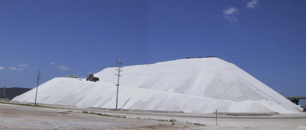
(c)U.S. Geological Survey:photo by S Corsi

Road salt, most commonly comprised of chloride and sodium (or chloride and another substance), dissolves readily in fresh water releasing chlorides into the environment. Chlorides are a growing concern to water scientists because they don’t break down, and once they’re in a water body there are no biological processes to remove them. Natural Chloride concentrations in fresh water are between 1 and 100 ppm (parts per million), that’s at or less than 0.01%. Chlorides can be toxic to aquatic plants and animals when levels go above these natural background concentrations, and they can also remain in the soil where they accumulate and become toxic to terrestrial plants and animals.

Chlorides interfere with an organism’s ability to regulate levels of salt and other substances within their bodily fluids. The effects vary by species type and location, but animals such as frogs and amphibians who lay eggs in “vernal pools,” or isolated bodies of water, may be especially at risk, as those water sources have no way of flushing out excess chlorides. Additionally, salt concentrations tend to spike in early spring (with the thawing of ground and snowmelt) and summer (when evaporation exceeds precipitation thereby concentrating salt), two critical times of year for amphibian reproduction and development.

How are public safety and water quality being addressed?

Salt pollution is challenging to address. Public safety and safe road conditions are paramount concerns, but protecting water quality needs to be considered as well. There are steps that can help address environmental concerns while still allowing safe road conditions and many groups are working to implement them. For example, the City of Newark, as well as most of our local municipalities, keep salt supplies covered and out of the elements to protect it directly from weather which would otherwise carry these chemicals into nearby water bodies. Some municipalities, such as the City of Newark also adopt Snow and Ice Control Plans that base salt application on snowfall amount and temperature, as well as primary areas of safety concern.

The long-term effects of chloride are still under study; as is research to find the most environmentally sound way to ensure public safety. Until a better solution is discovered try using some of the tips listed earlier on your property to help lessen salts from entering our waterways!

Want to learn more about how we are making progress addressing public safety and water quality? Check out some of these resources:

Chloride and Our Water –Monitoring the Mix (video)

University of New Hampshire Road Salt Reduction

New Hampshire Department of Environmental Services Road Salt Reduction Initiative

Capitol Region Watershed District, MN – Snow Removal and Salting Tips

Star Tribune (MN) - Road salt use gets weighed against saving money, environment


White Clay Creek: A Wild and Scenic River Partnership

There are only 208 Wild and Scenic Rivers, select rivers of the U.S., which possess outstandingly remarkable scenic, recreational, geologic, fish and wildlife, historic, and or cultural values. To put this into perspective, less than half of one percent of all American rivers are awarded this title. White Clay Creek is one of them.

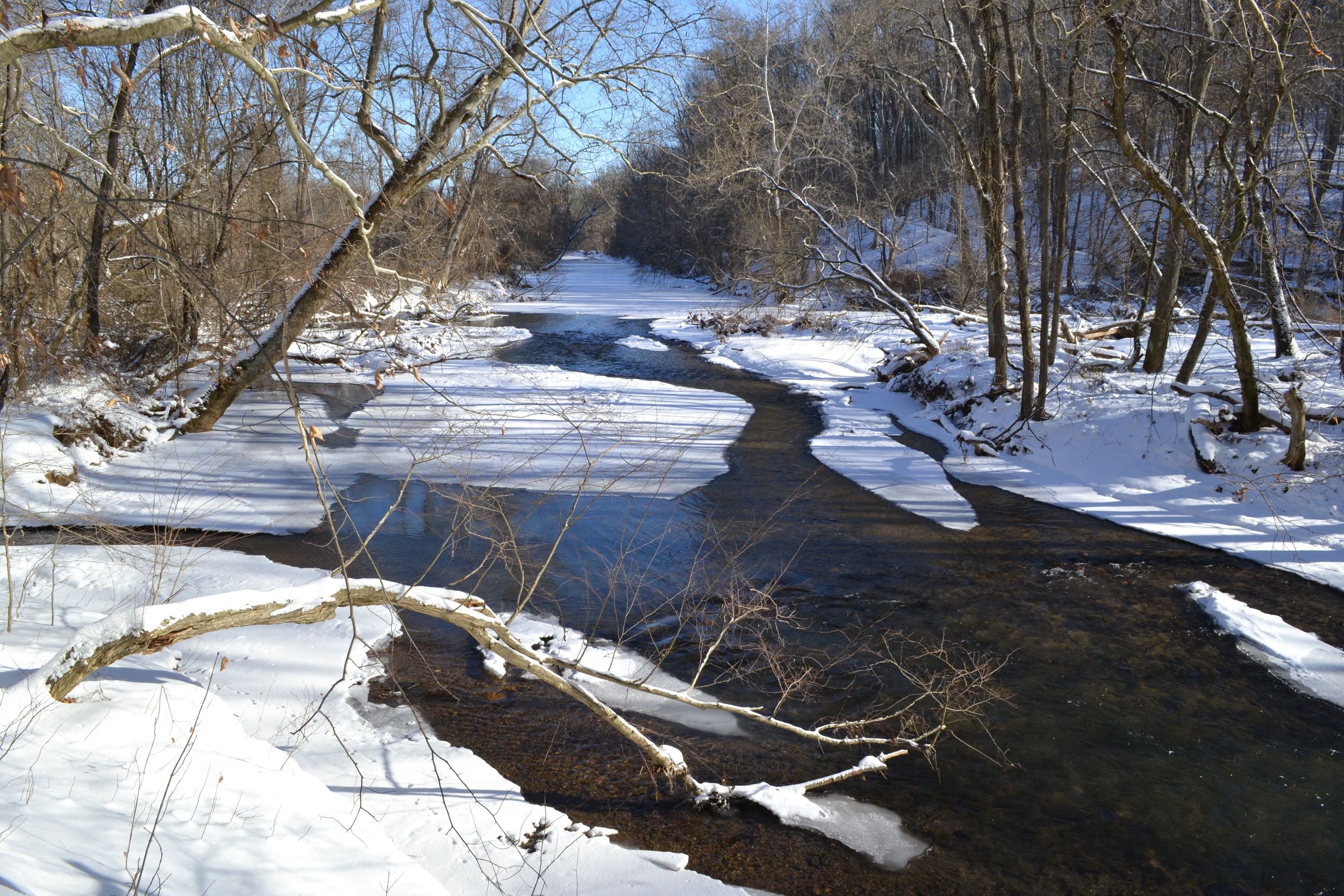
WCC-in-Winter-2014The White Clay Creek is unique in that it was the first Wild and Scenic River to be protected on a watershed basis rather than just focusing on a section of the river. This approach takes into consideration the variety of influences outside the river corridor that affect river habitat and water quality. White Clay Creek is a 107square-mile watershed, containing approximately 200 stream miles, primarily made up of small order streams on private lands. In order to adequately safeguard river habitat and water quality for future generations, it made sense to ensure the protection of these smaller headwater streams and tributaries, which are highly influenced by local land uses.

People don’t always make this connection between land and water. On a typical rainy day, most people probably aren’t thinking about where the water that hits their property (roof, driveway, backyard) is going or what pollutants may be carried with it into local streams. Local land use, including stormwater management and agricultural practices, can have a huge impact on water quality and quantity. The White Clay Creek Wild & Scenic Watershed Management Plan encompasses the entire watershed, both land and waterways, allowing the White Clay Wild and Scenic Steering Committee and its many partners to implement projects and promote actions outside the river corridor that benefit our river habitat and water quality.

Partnership rivers?shane's pic laurel hieghts wcc

Rivers such as the White Clay Creek that run through private lands rely on the “Partnership” Wild and Scenic River model of river management. Only 12 rivers (less than 6% of all Wild and Scenic Rivers) are managed as Partnership Wild and Scenic Rivers including Farmington River in Connecticut, the Musconetcong and Great Egg Harbor Rivers in New Jersey, the Lower Delaware River in New Jersey and Pennsylvania and the Wekiva River in Florida.

Yet this model has proven to be very successful.Partnership Rivers have a proven track record of being a cost effective and efficient way to protect private lands rivers. In fact, Partnership Rivers received the highest grades for compliance with the Wild and Scenic Rivers Act and river protection from the Wild and Scenic Rivers Task Force. In 2007 Harvard University’s Ash Institute for Democratic Governance and Innovation honored the Partnership program as a top innovation exemplifying public and private partnerships.

Successes? To highlight some of our successes, since 2005, the White Clay Wild and Scenic Steering Committee has on average, matched our federal funds 1:1. In other words, every dollar of federal funds received has been matched 100% over the past decade.  In fact, just in the past two years we have seen an even greater match of 1:2.

Simply put, the federal funds we receive get put to good use. They are put towards landowner-supported conservation easements, best management practices such as stormwater basin retrofits and manure management practices, dam removal, reforestation, and education and outreach efforts that are supported by our local partners. Our partners include municipalities, water utilities, state and county agencies, other non-profits, private donors, and of course local citizens and Steering Committee members who volunteer their time.

Perhaps the biggest success is our Open Space program. Since our designation in late 2000, we have preserved just under 2000 additional acres of land valued at $26 million at a cost of just $127,500 in federal funds.  Our reforestation program, initiated in 2010, has planted 7,500 trees, or 24 riparian acres, at a cost of $12,442 in federal funds.  This past year White Clay Wild & Scenic Steering Committee supported the University of Delaware’s Water Resources Agency with the first documented dam removal in the State of Delaware. The dam was also the first to be removed for shad restoration along the White Clay Creek.

Finally, in December of 2014, nine additional stream miles were added to the White Clay Creek’s Wild and Scenic designation, bringing the total designated stream miles to 199. These two additional stream segments will now receive the same protection as the original 190 miles in terms of federal assistance for any water resource projects that may pose a potential adverse impact to the creek or its resources.

DesigArea2015jpg

Our Wild & Scenic partnership first gained the support of the two local municipalities containing the stream segments no longer deemed necessary for future water supply. Then, we found champions in the Senate and House to sponsor the legislation to include these new stream segments. This support enabled us to expand protection for our river with no federal land acquisition and at no cost to taxpayers. How is that not a win-win?

*This post was originally published by American Rivers. To learn more about American Rivers please visit their website at www.AmericanRivers.org.